

IRTC GT Explanation - March 2009 (2)
.pdfGulf of Aden Internationallyy
Recommended Transit Corridoror &&
Group Transit Explanation
The following information is intended to clarify the purpose & scope of the Transit Corridor and to outline the practical aspects for merchant vessels participating in Group Transits.
Correct MarchMarch 20092009
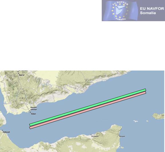
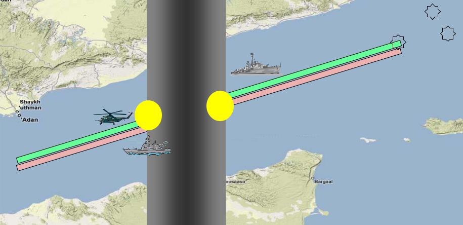
IR Transit Corridor
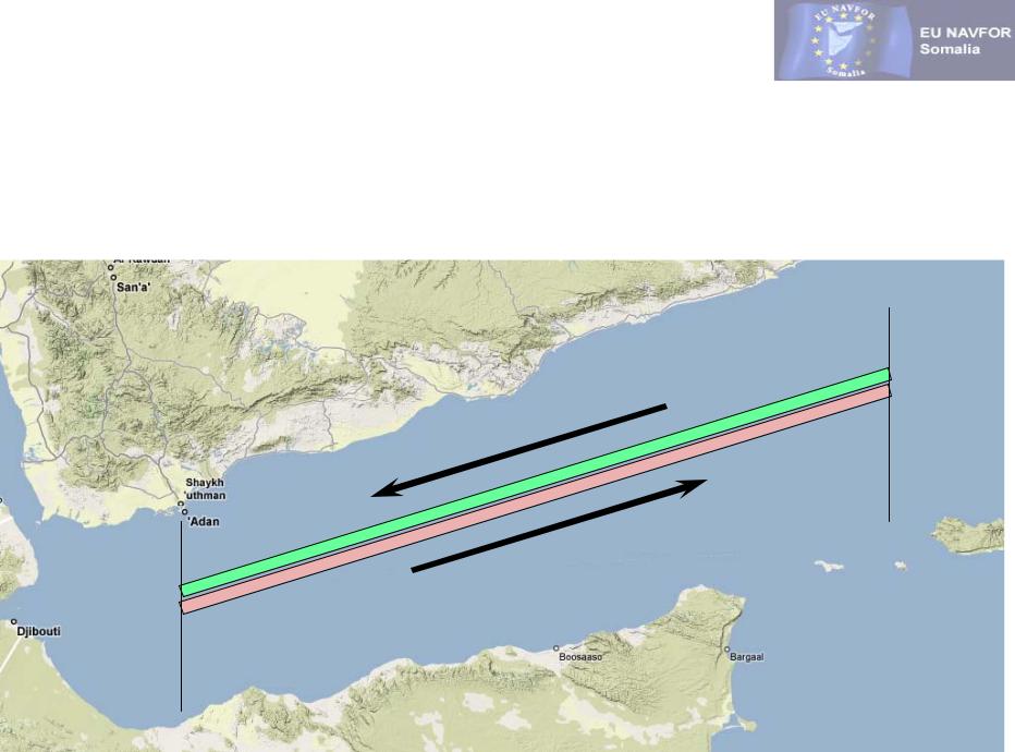
On the 1st of Feb 2009 the IRTC was amended to reflect revised analysis of GOA pirate activity and shipping industry feedback. The revised corridor has also been positioned further from established fishing areas resulting in a decrease in false piracy alerts.
The change has resulted in the introduction of
East bound
and
West bound
corridors.
The corridor is not marked or defined by visual navigational means, nor is it intended to be a dedicated TSS but, to make warship patrols more effective, vessels transiting the GOA are strongly recommended to adhere to the Transit Corridor and Group Transit guidelines.
IR Transit Corridor
The East bound corridor starts at 45° East between 11°53’ & 11°48’ North and terminates at 53° East between 14°23’ & 14°18’ North.
The West bound corridor starts at 53° East between 14°30’ & 14°25’ North and terminates at 45° East between 12°00’ & 11°55’ North.
053°E
252°
072°
045°E
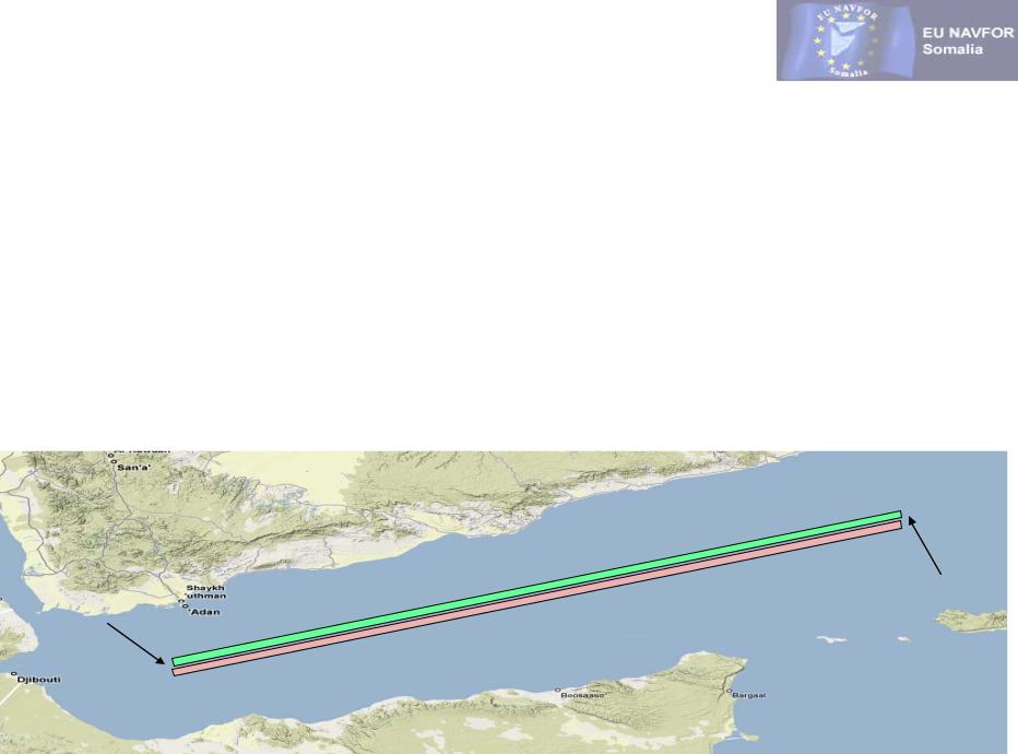
All illustrations & distances are approximate

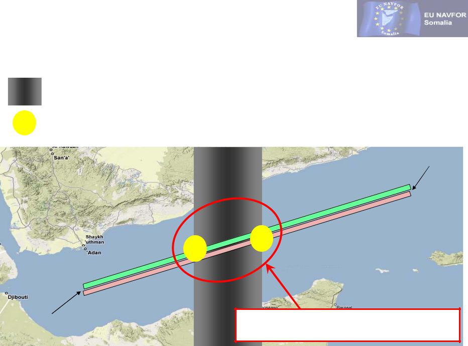
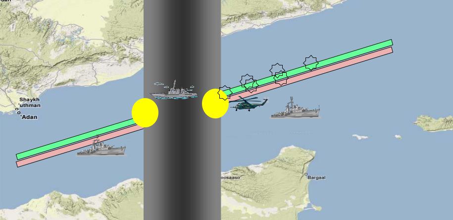
Group Transits
Group Transits have been developed after analysis of GOA pirate activity and are designed to group transiting vessels together and exploit the additional protection and assurance that can be gained from grouping vessels together.
Analysis of successful and attempted pirate attacks clearly indicate that piracy attacks during darkness are infrequent and, at this time, have a zero success rate in the region.
With this in mind Group Transits have been timed to ensure that vessels transit the most vulnerable area at night.
The secondary objective of the Group Transit system is to group together all vessels (regardless of their speed) around the time of daybreak ensuring that during what is potentially the most vulnerable time of a vessels transit vessels are grouped together.
The above factors allow the military to best position assets in the area to deter and protect against hijacking.
Group Transits
Area of greatest threat (statistically). Note that this is continuously reviewed and may be adjusted over time.
Night time / darkness transit section (approximate)
Most vulnerable time / area of GT
Point “B”
Point “A”
Approximate region where military forces are concentrating piracy surveillance efforts.
All illustrations & distances are approximate
Group Transit Groupings
Speed |
Eastbound Transit |
Westbound Transit |
||
(SOG/GPS) |
Entry Point “A” |
Entry Point “B” |
||
10 kts |
01:00 (Z) |
04:00 (Lt) |
15:00 (Z) |
18:00 (Lt) |
|
|
|
|
|
12 kts |
05:30 (Z) |
08:30 (Lt) |
21:00 (Z) |
00:01 (Lt) |
|
|
|
|
|
14 kts |
08:30 (Z) |
11:30 (Lt) |
01:00 (Z) |
04:00 (Lt) |
|
|
|
|
|
16 kts |
11:00 (Z) |
14:00 (Lt) |
05:30 (Z) |
08:30 (Lt) |
|
|
|
|
|
18 kts |
13:00 (Z) |
16:00 (Lt) |
07:00 (Z) |
10:00 (Lt) |
|
|
|
|
|
Point “A” |
Point “B” |
|
All illustrations & distances are approximate
Westbound GT Case Study 
Vessel ID |
Vessel Type |
Transit Speed |
Vessel ID |
Vessel Type |
Transit Speed |
Ship A |
VLCC |
12 kts |
Ship D |
Offshore Supply |
10 kts |
|
|
|
|
|
|
Ship B |
Bulk Carrier |
14 kts |
Ship E |
Car Carrier |
14 kts |
|
|
|
|
|
|
Ship C |
LNG Carrier |
18 kts |
Ship F |
General Cargo |
12 kts |
|
|
|
|
|
|
Time : 15:00 (Z)
FF
AA
DD
All illustrations & distances are approximate

Westbound GT Case Study 
Vessel ID |
Vessel Type |
Transit Speed |
Vessel ID |
Vessel Type |
Transit Speed |
Ship A |
VLCC |
12 kts |
Ship D |
Offshore Supply |
10 kts |
|
|
|
|
|
|
Ship B |
Bunk Carrier |
14 kts |
Ship E |
Car Carrier |
14 kts |
|
|
|
|
|
|
Ship C |
LNG Carrier |
18 kts |
Ship F |
General Cargo |
12 kts |
|
|
|
|
|
|
BB CC
F EE
A
D
All illustrations & distances are approximate
Westbound GT Case Study 
Vessel ID |
Vessel Type |
Transit Speed |
Vessel ID |
Vessel Type |
Transit Speed |
Ship A |
VLCC |
12 kts |
Ship D |
Offshore Supply |
10 kts |
|
|
|
|
|
|
Ship B |
Bunk Carrier |
14 kts |
Ship E |
Car Carrier |
14 kts |
|
|
|
|
|
|
Ship C |
LNG Carrier |
18 kts |
Ship F |
General Cargo |
12 kts |
|
|
|
|
|
|
C
B
F E
A
D
All illustrations & distances are approximate

Westbound GT Case Study 
Vessel ID |
Vessel Type |
Transit Speed |
Vessel ID |
Vessel Type |
Transit Speed |
Ship A |
VLCC |
12 kts |
Ship D |
Offshore Supply |
10 kts |
|
|
|
|
|
|
Ship B |
Bunk Carrier |
14 kts |
Ship E |
Car Carrier |
14 kts |
|
|
|
|
|
|
Ship C |
LNG Carrier |
18 kts |
Ship F |
General Cargo |
12 kts |
|
|
|
|
|
|
B
F C
DAE
All Westbound Transit vessels are grouped |
together when passing through what EU NAVFOR |
believe to be the most vulnerable phase of the |
transit which allows naval forces to offer |
protection for all transit vessels during this time. |
All illustrations & distances are approximate