

METEOROLOGY
.pdf10 DEC 10 |
METEOROLOGY |
87 |
METEOROLOGICAL SERVICE FOR INTERNATIONAL AIR TRAFFIC / FORECAST - ANNEX 3
© JEPPESEN, 1999, 2010. ALL RIGHTS RESERVED.

88 |
METEOROLOGY |
10 DEC 10 |
METEOROLOGICAL SERVICE FOR INTERNATIONAL AIR TRAFFIC / FORECAST - ANNEX 3
© JEPPESEN, 1999, 2010. ALL RIGHTS RESERVED.

10 DEC 10 |
METEOROLOGY |
89 |
METEOROLOGICAL SERVICE FOR INTERNATIONAL AIR TRAFFIC / FORECAST - ANNEX 3
NSC |
FM051230 15015KMH 9999 |
|
BKN020 |
|
(FM051230 15008KT 9999 |
|
BKN020) |
1 Fictitious location.
2 To be used in accordance with 1.2.1.
3 To be included in accordance with 1.2.1.
4 To be included whenever applicable.
5 One or more, up to a maximum of three, groups in accordance with 1.2.3.
6 To be included whenever applicable in accordance with 1.2.3. No qualifier for moderate intensity. 7 Weather phenomena to be included in accordance with 1.2.3.
8 Up to four cloud layers in accordance with 1.2.4.
9To be included in accordance with 1.2.5, consisting of up to a maximum of four temperatures (two maximum temperatures and two minimum temperatures).
10 To be included in accordance with 1.3, 1.4 and 1.5.
© JEPPESEN, 1999, 2010. ALL RIGHTS RESERVED.

90 |
METEOROLOGY |
10 DEC 10 |
METEOROLOGICAL SERVICE FOR INTERNATIONAL AIR TRAFFIC / FORECAST - ANNEX 3
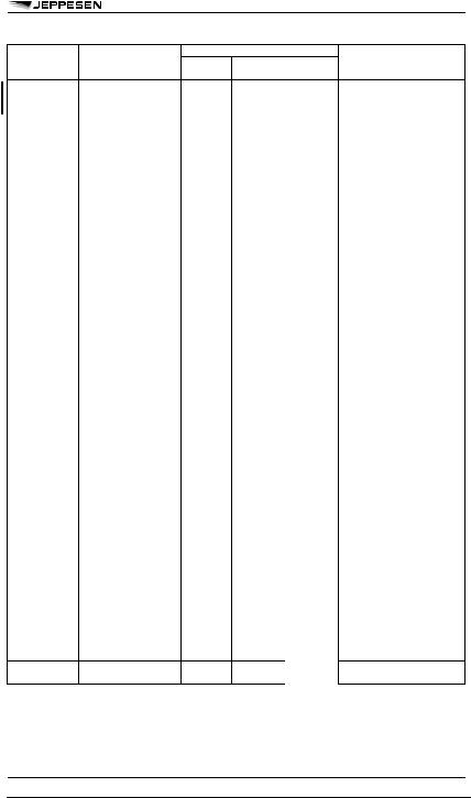
Table A5-2. Use of change and time indicators in TAF
PROBnn |
probability of occurrence (in%) of |
— |
|
||
|
an alternative value of a forecast |
|
© JEPPESEN, 1999, 2010. ALL RIGHTS RESERVED.
10 DEC 10 |
METEOROLOGY |
91 |
METEOROLOGICAL SERVICE FOR INTERNATIONAL AIR TRAFFIC / FORECAST - ANNEX 3
© JEPPESEN, 1999, 2010. ALL RIGHTS RESERVED.

92 |
METEOROLOGY |
10 DEC 10 |
METEOROLOGICAL SERVICE FOR INTERNATIONAL AIR TRAFFIC / FORECAST - ANNEX 3
© JEPPESEN, 1999, 2010. ALL RIGHTS RESERVED.

10 DEC 10 |
METEOROLOGY |
93 |
METEOROLOGICAL SERVICE FOR INTERNATIONAL AIR TRAFFIC / FORECAST - ANNEX 3
Pressure |
Pressure centres |
PSYS: [nn] |
centres and |
and fronts and their |
|
fronts (M) |
expected movements |
|
|
and developments |
|
Nnnnn or |
PSYS: 06 L 1004 HPA N5130 |
Snnnn |
E01000 MOV NE 25KT WKN |
Wnnnnn or Ennnnn
or Nnnnn or Snnnn
Nnnnn or Snnnn
Wnnnnn or Ennnnn
or [N of Nnn or Snn]
or [S of Nnn or Snn]
or [W of Wnnn or Ennn]
or [E of Wnnn or Ennn]
or [nnnnnnnn nn]1
1 Free text describing well-known geographical locations should be kept to a minimum.
2The location of the CB and/or TCU should be specified in addition to any widespread areas of broken or overcast cloud as given in the example.
3 When no elements are included in Section I.
© JEPPESEN, 1999, 2010. ALL RIGHTS RESERVED.

94 |
METEOROLOGY |
10 DEC 10 |
METEOROLOGICAL SERVICE FOR INTERNATIONAL AIR TRAFFIC / FORECAST - ANNEX 3
Table A5-4. Ranges and resolutions for the numerical elements included in TAF
1 There is no aeronautical requirement to report surface wind speeds of 50m/s (100kt) or more; however, provision has been made for reporting wind speeds up to 99m/s (199kt) for non-aeronautical purposes, as necessary.
EXAMPLE:
A5-1. TAF
TAF for YUDO (Donlon/International)1
TAF YUDO 160000Z 1606/1624 13005MPS 9000 BKN020 BECMG 1606/1608 SCT015CB BKN020 TEMPO 1608/1612 17006G12MPS 1000 TSRA SCT010CB BKN020 FM161230 15004MPS 9999 BKN020
Meaning of the forecast:
TAF for Donlon/International1 issued on the 16th of the month at 0000 UTC valid from 0600 UTC to 2400 UTC on the 16th of the month; surface wind direction 130 degrees; wind speed 5 meters per second; visibility 9 kilometers, broken cloud at 600 meters; becoming between 0600 UTC and 0800 UTC on the 16th of the month, scattered cumulonimbus cloud at 450 meters and broken cloud at 600 meters; temporarily between 0800 UTC and 1200 UTC on the 16th of the month surface wind direction 170 degrees; wind speed 6 meters per second gusting to 12 meters per second; visibility 1000 meters in a thunderstorm with moderate rain, scattered cumulonimbus cloud at 300 meters and broken cloud at 600 meters; from 1230
UTC on the 16th of the month surface wind direction 150 degrees; wind speed 4 meters per second; visibility 10 kilometers or more; and broken cloud at 600 meters.
1 Fictitious location
NOTE: In this example, the primary units "meter per second" and "meter" were used for wind speed and height of cloud base, respectively. However, in accordance with Annex 5, the corresponding non-SI alternative units "knot" and ’foot" may be used instead.
EXAMPLE:
A5-2. Cancellation of TAF
Cancellation of TAF for YUDO (Donlon/International)1 TAF AMD YUDO 161500Z 1606/1624 CNL Meaning of the forecast:
Amended TAF for Donlon/International1 issued on the 16th of the month at 1500 UTC cancelling the previously issued TAF valid from 0600 UTC to 2400 UTC on the 16th of the month.
1 Fictitious location EXAMPLE:
© JEPPESEN, 1999, 2010. ALL RIGHTS RESERVED.

10 DEC 10 |
METEOROLOGY |
95 |
METEOROLOGICAL SERVICE FOR INTERNATIONAL AIR TRAFFIC / FORECAST - ANNEX 3
A5-3. GAMET area forecast (continued)
© JEPPESEN, 1999, 2010. ALL RIGHTS RESERVED.

|
10 DEC 10 |
METEOROLOGY |
101 |
||
|
METEOROLOGICAL SERVICE FOR INTERNATIONAL AIR TRAFFIC / |
||||
|
SIGMET, AIRMET, WSW - ANNEX 3 |
||||
Appendix 6. Technical Specifications related |
1.1.2 |
Messages containing SIGMET infor- |
|||
to Sigmet and Airmet Information, Aerodrome |
mation for subsonic aircraft shall be identified as |
||||
Warnings and Wind Shear Warnings and Alerts |
"SIGMET". |
|
|||
(See Chapter 7 of this Annex.) |
|
1.1.3 |
The sequence number referred to in the |
||
NOTE: Data type designators to be used in abbrevi- |
template in Table A6-1 shall correspond with the |
||||
ated headings for SIGMET, AIRMET tropical cyclone |
number of SIGMET messages issued for the flight |
||||
and volcanic ash advisory messages are given in |
information region since 0001 UTC on the day con- |
||||
WMO Publication No. 386, Manual on the Global |
cerned. The meteorological watch offices whose |
||||
Telecommunication System. |
|
area of responsibility encompasses more than one |
|||
1. SPECIFICATIONS RELATED TO |
FIR and/or CTA shall issue separate SIGMET mes- |
||||
sages for each FIR and/or CTA within its area of |
|||||
SIGMET INFORMATION |
|
responsibility. |
|||
1.1 FORMAT OF SIGMET MESSAGES |
1.1.4 |
In accordance with the template in Table |
|||
1.1.1 |
The content and order of elements in a |
A6-1, only one of the following phenomena shall be |
|||
included in a SIGMET message, using the abbrevia- |
|||||
SIGMET message shall be in accordance with the |
|||||
tions as indicated below: |
|||||
template shown in Table A6-1. |
|
||||
|
|
|
|||
At cruising levels (irrespective of altitude): |
|
|
|
||
Thunderstorm |
|
|
|
||
- |
obscured |
|
|
OBSC TS |
|
- |
|
|
|||
embedded |
|
|
EMBD TS |
||
- |
|
|
|||
frequent |
|
|
FRQ TS |
||
- |
|
|
|||
squall line |
|
|
SQL TS |
||
- |
|
|
|||
obscured with hail |
|
|
OBSC TSGR |
||
- |
|
|
|||
embedded with hail |
|
|
EMBD TSGR |
||
- |
|
|
|||
frequent, with hail |
|
|
FRQ TSGR |
||
- |
|
|
|||
squall line with hail |
|
|
SQL TSGR |
||
|
|
|
|||
Tropical Cyclone |
|
|
|
||
- |
tropical cyclone with 10-minute surface wind speed of 17 m/s |
TC (+ cyclone name) |
|||
|
|||||
|
(34 kt) or more |
|
|
|
|
Turbulence |
|
|
|
||
- |
severe turbulence |
|
|
SEV TURB |
|
|
|
|
|||
Icing |
|
|
|
|
|
- |
severe icing |
|
|
SEV ICE |
|
- |
|
|
|||
icing due to freezing rain |
|
|
SEV ICE (FZRA) |
||
|
|
|
|||
Mountain Wave |
|
|
|
||
- |
severe mountain wave |
|
|
SEV MTW |
|
|
|
|
|||
Duststorm |
|
|
|
||
- |
heavy duststorm |
|
|
HVY DS |
|
|
|
|
|||
Sandstorm |
|
|
|
||
- |
heavy sandstorm |
|
|
HVY SS |
|
|
|
|
|||
Volcanic Ash |
|
|
|
||
- |
volcanic ash |
|
|
VA (+ volcano name, if known) |
|
|
|
|
|||
Radioactive Cloud |
|
|
RDOACT CLD |
||
1.1.5SIGMET information shall not contain unnecessary descriptive material. In describing the weather phenomena for which the SIGMET is issued, no descriptive material additional to that given in 1.1.4 shall be included. SIGMET information concerning thunderstorms or a tropical cyclone shall not include references to associated turbulence and icing.
1.1.6Recommendation. - Meteorological watch offices in a position to do so should issue SIGMET information in graphical format using the WMO
BUFR code form, in addition to the issuance of this SIGMET information in abbreviated plain language in accordance with 1.1.1.
NOTE: The BUFR code form is contained in WMO Publication No. 306, Manual on Codes, Volume 1.2, Part B - Binary Codes.
© JEPPESEN, 2005, 2010. ALL RIGHTS RESERVED.