

Sec. 5. The Method of Projections. The Representation of the Earth Surface
The method of projections. When we speak of a representation of the earth surface what we mean are the contours or outlines of natural or man-made features, such as lakes, rivers, canals, roads, and forests as well as those of the relief features such as mountains, basins, saddles.
Since it is possible to regard the Earth at the first approximation as being a sphere, it is rational to obtain a representation of the earth's surface on a sphere. For some practical purposes one may take the shape of the Earth to be a spheroid. In doing so one will assume that the surface of the geoid and that of the spheroid agree and are the same level surface (Fig. 2) The actual earth's surface is complicated in shape. It contains ground irregularities such as mountains, basins, and gullies, whilst flat regions seldom occur. When studying the earth's physical surface it is assumed that points on it, e.g. A, B, C, D, and E, are projected by plumb lines on the level, that is, horizontal surface MN. Thus we obtain the points a, b, c, d, and e, and these are called horizontal projections of the corresponding points on the earth's physical surface. Each line or contour on the earth’s physical surface corresponds to a line or a contour on the imaginary level surface.
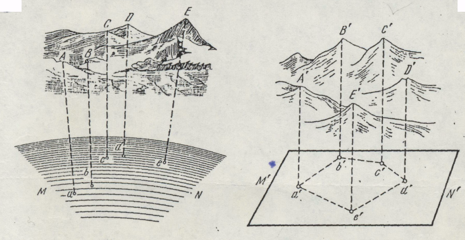
Fig. 2
Fig. 3
This is true for curvilinear outlines as well. However, spherical surfaces are inconvenient to deal with and it is practice to use plane representations of the earth's surface. In order to reduce a spherical level surface, together with its horizontal projections of the earth's physical features, to a plane representation special cartographic projections are used. The conformal map projection is the cartographic projection usually used.
Thus there are three problems of studying the earth's physical surface: (1) the determination of the position of the horizontal projections of the points on the level surface MN in a definite coordinate system; (2) the establishment of the heights (Aa, Bb, ...) of the points of the earth's physical surface above the level surface, and (3) the transformation of the spherical level surface to a plane map projection.